
HOT AND INCREASINGLY HUMID
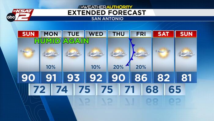
You’ll definitely notice a shift by Monday morning as lows climb into the upper 60s and lower 70s. Monday will remain hot, and heat indices will reach the mid-90s to near 100.

Isolated showers or thunderstorms are possible, primarily across the Coastal Plains and the eastern I-35 corridor, though most areas will stay dry. Through midweek, isolated storm chances will persist across the Coastal Plains, with the sea breeze occasionally pushing activity inland toward the I-35 corridor.
RAIN CHANCES AND A POSSIBLE COLD FRONT?
Late week, an upper-level disturbance could bring a cold front to South Texas, though the intensity and exact timing remain uncertain. Expect hot, humid conditions early this week with limited rain chances ahead of the potential front.


